Property Record
1420 W Highway 166, Bowdon, GA 30108
NEARBY LISTINGS FOR SALE OR LEASE
-
-
View all Bowdon listings for sale on LoopNet.com
Property Detail
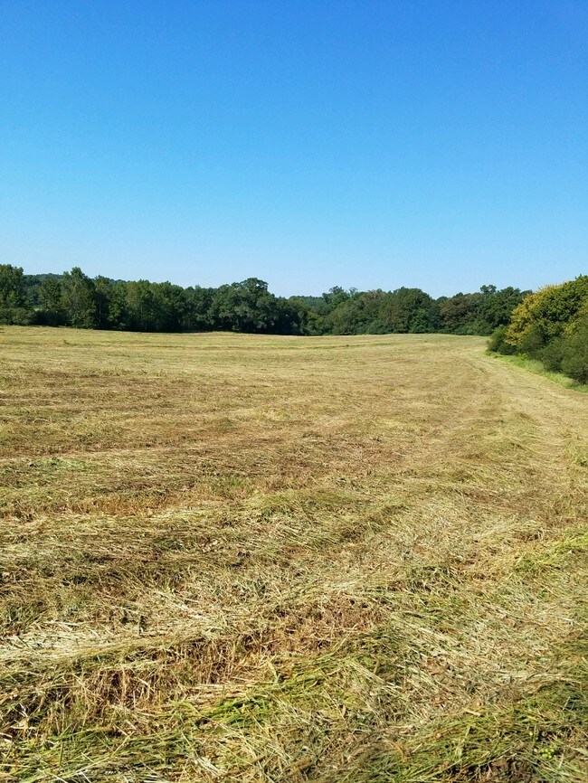
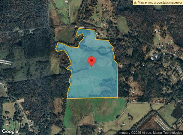
1420 W Highway 166
Atlanta-Sandy Springs-Roswell, GA
Roy Styles Surv
015-0102
V/124.30AC HWY 166 W
Governmentalpublicusegeneral
Carroll
A
Georgia
01029C0400C
124.30 AC
2025
W Carroll County
2025
Atlanta
911202
DEMOGRAPHICS near 1420 W Highway 166
1 Mile
3 Mile
5 Mile
2024 Total Population
662
4,654
8,596
2029 Population
739
5,169
9,470
Pop Growth 2024-2029
+ 11.63%
+ 11.07%
+ 10.17%
Average Age
40
40
41
2024 Total Households
262
1,848
3,429
HH Growth 2024-2029
+ 11.45%
+ 11.09%
+ 10.09%
Median Household Inc
$37,578
$44,705
$48,434
Avg Household Size
2.50
2.50
2.50
2024 Avg HH Vehicles
2.00
2.00
2.00
Median Home Value
$224,107
$215,578
$220,397
Median Year Built
1980
1974
1978
Nearby Places
- Restaurants
- Banks
- Shops
- Fitness
- Groceries
SALE & LEASE HISTORY
LISTING DATE
SALE/LEASE

Apr 12, 2019
For Sale
Nearby Properties
Address
Land Use
TOTAL SIZE
Lot Size
Zoning
Address
Land Use
TOTAL SIZE
Lot Size
Zoning
103,228 SF
23.61 AC
R
Address
Land Use
TOTAL SIZE
Lot Size
Zoning
9.55 AC
001
Address
Land Use
TOTAL SIZE
Lot Size
Zoning
40,000 SF
5.51 AC
R
Address
Land Use
TOTAL SIZE
Lot Size
Zoning
13,785 SF
9.80 AC
R
Address
Land Use
TOTAL SIZE
Lot Size
Zoning
29,902 SF
25.35 AC
C
Address
Land Use
TOTAL SIZE
Lot Size
Zoning
18,807 SF
7.56 AC
002
Address
Land Use
TOTAL SIZE
Lot Size
Zoning
40,890 SF
5.88 AC
C
Address
Land Use
TOTAL SIZE
Lot Size
Zoning
19,176 SF
5 AC
C
Address
Land Use
TOTAL SIZE
Lot Size
Zoning
1,080 SF
468.65 AC
MULTI
Address
Land Use
TOTAL SIZE
Lot Size
Zoning
28,100 SF
6.95 AC
C
Address
Land Use
TOTAL SIZE
Lot Size
Zoning
62,246 SF
4.77 AC
C
Address
Land Use
TOTAL SIZE
Lot Size
Zoning
36,440 SF
41.23 AC
I
Address
Land Use
TOTAL SIZE
Lot Size
Zoning
29,958 SF
4.74 AC
001
Address
Land Use
TOTAL SIZE
Lot Size
Zoning
27,800 SF
5.33 AC
C
Address
Land Use
TOTAL SIZE
Lot Size
Zoning
16,872 SF
4.47 AC
C
Address
Land Use
TOTAL SIZE
Lot Size
Zoning
18,848 SF
23 AC
Address
Land Use
TOTAL SIZE
Lot Size
Zoning
164.19 AC
A
Address
Land Use
TOTAL SIZE
Lot Size
Zoning
10,050 SF
0.77 AC
002
Address
Land Use
TOTAL SIZE
Lot Size
Zoning
9,000 SF
3.84 AC
C
Address
Land Use
TOTAL SIZE
Lot Size
Zoning
3,840 SF
0.46 AC
C
Address
Land Use
TOTAL SIZE
Lot Size
Zoning
11,204 SF
1.19 AC
C
Address
Land Use
TOTAL SIZE
Lot Size
Zoning
3,042 SF
3.78 AC
R
Address
Land Use
TOTAL SIZE
Lot Size
Zoning
9,127 SF
8.53 AC
C
Address
Land Use
TOTAL SIZE
Lot Size
Zoning
65,346 SF
4.78 AC
I
Address
Land Use
TOTAL SIZE
Lot Size
Zoning
132.44 AC
A
Address
Land Use
TOTAL SIZE
Lot Size
Zoning
2,400 SF
107.22 AC
A
Address
Land Use
TOTAL SIZE
Lot Size
Zoning
74.60 AC
RESIDENTIA
Address
Land Use
TOTAL SIZE
Lot Size
Zoning
10,000 SF
2.21 AC
003
Address
Land Use
TOTAL SIZE
Lot Size
Zoning
7,632 SF
0.27 AC
C
The World's #1 Commercial Real Estate Marketplace
Connect with us
© 2025 CoStar Group
The information above has been obtained from sources believed reliable. While we do not doubt its accuracy we have not verified it and make no guarantee, warranty or representation about it. It is your responsibility to independently confirm its accuracy and completeness. Any projections, opinions, assumptions, or estimates used are for example only and do not represent the current or future performance of the property. The value of this transaction to you depends on tax and other factors which should be evaluated by your tax, financial, and legal advisors. You and your advisors should conduct a careful, independent investigation of the property to determine to your satisfaction the suitability of the property for your needs.